


Read the original article on WHRO's website.
The historic Norfolk neighborhood of Chesterfield Heights is especially vulnerable to rising waters. It sits along the Elizabeth River and was built starting in 1915 by filling in creeks and covering soil that once helped absorb water.
Only two roads provide access in and out, and they’ve been swamped during storms — particularly Hurricane Irene in 2011. Flood insurance bills have risen steadily.
A project nearly a decade in the making now aims to protect the community from future catastrophe.
The city spent $112 million from the federal government on the Ohio Creek Watershed Project, which also includes the neighboring Grandy Village public housing complex.
After more than three years of construction, city officials say it's complete.
“This is probably the best example that we have in the entire region and state of Virginia, where we are building resilience, adapting to climate change at the same time and working with the community,” said Kyle Spencer, Norfolk’s chief resilience officer.
Leaders around Virginia and beyond say they’re looking to the project as a potential model for how to brace vulnerable communities for rising waters — before disaster strikes.
And it all started with a group of college students.
Zach Robinson was an architecture student at Hampton University about a decade ago. He was part of a class effort studying how urban design could help with flooding and sea level rise.
The Tidewater Rising Resiliency Design Challenge was a collaboration with Old Dominion University and Norfolk nonprofit Wetlands Watch, which called it “one of the nation’s only pre-disaster, real world adaptation design efforts.”
The team looked at several vulnerable neighborhoods and homed in on Chesterfield Heights, which experiences regular tidal flooding in addition to during storms.
Their civic league asked the students to help find solutions, said Robinson, who’s now an urban designer at WPA Architects in Norfolk.
Chesterfield Heights is a majority-Black neighborhood with a mix of middle and low incomes.
It was initially laid out in 1904 by the Chesterfield Syndicate Corporation “as an elite residential suburb,” according to the Virginia Department of Historic Resources.
World War I forced the community to reduce lot sizes as competition among suburban neighborhoods grew, leading it to attract more middle-income residents, the department says.
It’s now a state historic district and was listed on the National Register of Historic Places in 2003.
Many residents have lived there for generations and have a strong sense of community, Robinson said.
“When I first met the community, their biggest concern was the effect of the flooding, but more so the cost on them, and also keeping these homes in their families,” he said. “They’re very protective of their area.”
The students heard complaints about flooded streets, especially stormwater lines often clogged with debris. Residents would routinely wade into intersections to clear them.
Robinson said the group originally thought they could solve flooding woes with traditional architecture solutions like raising homes and filling in basements.
But many residents were “concerned about how traditional home elevation might endanger the neighborhood’s historic status, or diminish the neighborhood’s strong ‘porch culture,’” according to the resiliency challenge website.
The research team started looking at community-wide approaches instead, Robinson said.
Eventually they presented their ideas to city officials, proposing options like installing living shoreline and permeable pavement, which allows water to filter down into the ground.
And the city listened.
At the time, Norfolk was already planning to apply to the National Disaster Resilience Competition under the U.S. Department of Housing and Urban Development, Spencer said.
Inspired by the Hampton and ODU students’ report, they incorporated many of the ideas into the grant application.
The city used Hurricane Irene to demonstrate the need in Chesterfield Heights, Spencer said.
Water levels during the 2011 storm rose about 6 feet above sea level. Spencer said officials assessed what would happen in a few decades from now in the same type of situation — in addition to 2.5 feet of sea level rise.
“It just exacerbates and extends that amount of flooding farther, deeper into the neighborhood,” Spencer said.
HUD awarded the city $120 million, some of which went to create the nonprofit RISE Resilience Innovations.
Construction on the Ohio Creek Watershed Project began in early 2020 and wrapped up recently, prolonged by the pandemic.
The city built up multiple layers of defense, including a much-needed overhaul to the area’s stormwater infrastructure, Spencer said.
That includes two new pump stations that can handle a total of about 150 million gallons of water per day, forcing it back into the river.
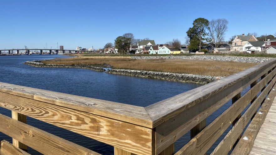
Photo by Katherine Hafner A street in Chesterfield Heights now made of permeable pavers that can absorb more water.There are also new bioswales, or vegetation-filled trenches along neighborhood streets to drain water and filter pollutants.
Norfolk took up the students’ suggestion to replace one brick street with permeable pavers.
They built a 2,500-foot earthen berm and some living shoreline along the river.
There are also more traditional forms of protection like a tide gate and small concrete floodwall. (Chesterfield Heights is situated just to the east of where Norfolk’s separate floodwall project will end.)
Federal officials often limit the way grant money can be used.
But Spencer said HUD allowed the city to incorporate community improvements as well, like a fishing pier and new resilience park.
The big questions are: Was it worth it? Will it work?
Residents of Chesterfield Heights were part of the planning and design process along the way. But some still have mixed feelings about the project.
It’s changed the landscape of their neighborhood, including obstructing treasured river views, and has been disruptive during years of construction.
Erik Barrett, a community activist and podcaster, grew up in Chesterfield Heights. He said his street never experienced much flooding — so it’s hard for some of his neighbors to grasp the immediate need for such massive changes.
“I like to say the city came to these fine folk and they said, like Noah did, that ‘I'm going to build an ark because it's going to rain.’ And these people never saw water,” Barrett said.
The city built lots of new things by really focusing on the future, he said.
“And so these fine folks are basically waiting for the great flood to happen. At least the ark is completed, right?”
It’s a challenge balancing long-term climate benefits while preserving the neighborhood’s existing character, Spencer acknowledges.
“When you do a large construction project like this, there’s always the trade-offs,” he said.
Some residents told WHRO they were sad to see the city cut down trees that have long lined the river.
Spencer said they’ve planted others, but they’ll take time to grow.
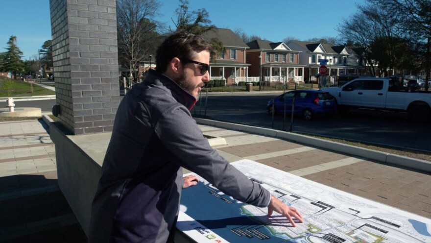
Robinson has now worked on the project professionally with WPA. He said it’s hard to put a price on home and community.
“So any time that you can keep somebody's quality of life good and keep them in a spot where they're comfortable and they enjoy being a citizen of a place that nurtures them, I think that's really the main goal.”